WASHINGTON, July 7 (San Diego News Online) — NOAA forecasters say El Niño conditions are already present and are expected to strengthen through the Northern Hemisphere winter of 2026-27.
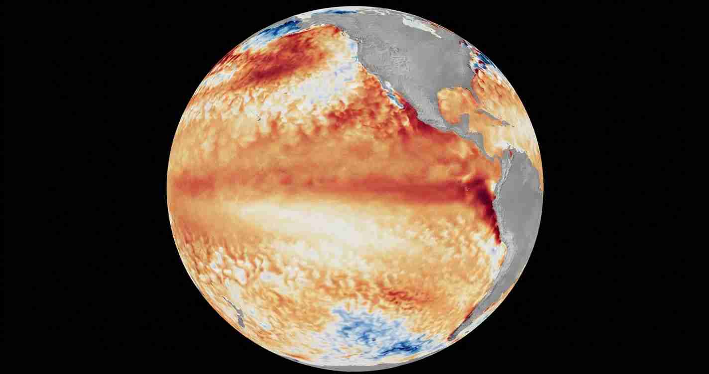
The Climate Prediction Center, NOAA’s main seasonal forecast office, issued an El Niño Advisory on June 11 and said the pattern is no longer just a possibility. In its diagnostic discussion, the agency said above-average sea-surface temperatures have spread across the central to eastern equatorial Pacific Ocean.
For people tracking winter weather, the practical takeaway is simple: keep watching NOAA’s seasonal updates over the next several months, because El Niño can change the odds for temperature, rainfall and coastal flooding patterns across parts of the United States.
What is El Niño?
El Niño is the warm phase of ENSO, short for El Niño-Southern Oscillation, a natural climate cycle tied to sea-surface temperatures and winds over the tropical Pacific. When waters in the central and eastern equatorial Pacific run warmer than average, the atmosphere can shift in ways that influence weather far from the ocean.
NOAA says the latest weekly Niño-3.4 index, one of the main gauges forecasters use to track the Pacific, stood at +0.7°C. The agency also reported Niño-4 at +0.7°C and Niño-1+2 at +2.1°C. Those readings show the warming has expanded beyond a single small area.
How strong could this one get?
NOAA says its model guidance, including the North American Multi-Model Ensemble and the NCEP CFSv2 model, points to further strengthening into winter. The Climate Prediction Center said there is a 63% chance of a very strong El Niño during November-January.
In NOAA’s wording, that could place the event among the largest in the historical record going back to 1950.
That does not mean every location will see the same weather. El Niño is a broad ocean-atmosphere pattern, not a local storm forecast. Its effects vary by region and by storm system.
Why does it matter?
NOAA’s Ocean Service says an El Niño can affect weather patterns across many parts of the U.S. and may increase the chance of high tide flooding in some coastal locations. That is one reason forecasters watch the Pacific so closely heading into fall and winter.
For readers in coastal areas, the most useful step is to follow NOAA’s updates and local tide or flood advisories as the season changes. For anyone planning around winter travel, agriculture, or coastal property, NOAA’s advisory is a reminder that seasonal outlooks can shift as the Pacific continues to warm.
What happens next?
NOAA will keep updating its forecast as ocean temperatures and atmospheric conditions evolve. For now, the agency’s message is clear: El Niño is present, it is likely to strengthen, and the winter outlook may keep changing as forecasters get closer to the November-January period.