WASHINGTON, Aug. 1 (DC Times Online) — The National Hurricane Center was forecasting no tropical activity in the Atlantic, Caribbean Sea or Gulf of Mexico through the following week in its Aug. 1 outlook, giving residents time to review forecasts and hurricane plans before conditions change.
The outlook came as El Niño continued to strengthen and oppose tropical development. The climate pattern can increase upper-level winds over the Atlantic, creating wind shear that disrupts thunderstorms and prevents tropical systems from organizing.
The quiet conditions do not mean the rest of the season will remain quiet. The hurricane season runs through Nov. 30, and the National Hurricane Center advises people in hurricane-prone areas to continue checking its official Tropical Weather Outlook rather than relying on the season’s early pace.
What is happening in the Atlantic?
As of July 31, the FOX Forecast Center said the basin had produced two named storms, one in June and one in July. Several tropical waves were also moving west from the African coast into the Atlantic’s Main Development Region, an area where many long-track hurricanes form.
A tropical wave is a broad area of unsettled weather, often containing showers and thunderstorms. Most waves do not become tropical storms. Their chances depend on several conditions working together, including warm ocean water, limited wind shear and enough moisture.
The National Hurricane Center’s seven-day outlook reported no areas of concern and no meaningful chance of tropical development in the near term. The agency’s Aug. 1 forecast covered the Atlantic basin, the Caribbean and the Gulf.
Why is El Niño important?
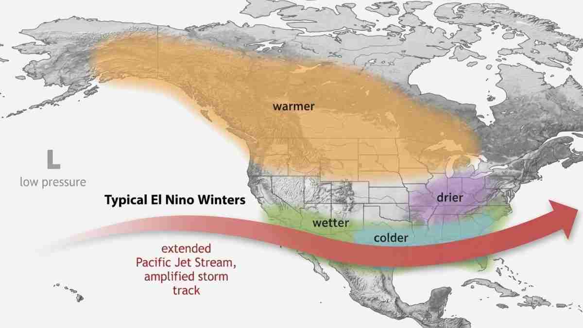
El Niño is a periodic warming of ocean water in the central and eastern tropical Pacific. It changes the position and strength of the jet stream and other large-scale wind patterns around the world.
For the Atlantic hurricane region, El Niño often produces stronger winds high in the atmosphere. Those winds can blow at different speeds or directions than winds near the ocean surface. This difference, called vertical wind shear, can tilt or tear apart a developing storm.
NOAA’s Climate Prediction Center and other forecasters said the 2026 El Niño was strengthening faster than previously expected. Climate forecasters described the event as potentially among the strongest El Niño episodes observed since 1950, although the supplied forecasts do not establish whether it will set a record.
North Carolina State University’s climate office reported in May that waters in the Atlantic Main Development Region were warmer than normal, a condition that could support storms. It also said the developing El Niño could strengthen upper-level winds over the tropical Atlantic. In other words, warm water is providing some fuel, while El Niño is helping provide an unfavorable atmosphere.
What role do dust and ocean temperatures play?
Saharan dust and dry, stable air were also suppressing thunderstorms across parts of the tropical Atlantic, according to the FOX Forecast Center and the National Hurricane Center outlook.
Dust carried west from Africa can reduce the moisture available to thunderstorms. Dry air can weaken the clusters of storms that tropical waves need in order to organize. Strong wind shear adds another obstacle.
Ocean temperatures remain important because tropical systems draw energy from warm water. But the FOX Forecast Center said the warm-water influence was being offset by El Niño and hostile upper-level winds.
The waves moving from Africa therefore cannot be judged by their presence alone. Forecasters must watch whether each wave encounters warm water, moist air and light enough winds to develop.
Does a slow start guarantee a slow season?
No. Seasonal hurricane forecasts describe the expected overall environment, not a guarantee about individual storms. A season with few early storms can still produce dangerous hurricanes later, especially when conditions change.
Forecasts cited by the FOX Forecast Center varied. NOAA projected 8 to 14 named storms, three to six hurricanes and one to three major hurricanes. Colorado State University projected 11 named storms, five hurricanes and two major hurricanes. AccuWeather projected 8 to 14 named storms, four to seven hurricanes and two to four major hurricanes.
A named storm has sustained winds of at least 39 mph. A hurricane reaches at least 74 mph, and a major hurricane is classified as Category 3 or higher, with sustained winds of at least 111 mph.
Those seasonal numbers also do not show where storms will go. A single storm can create serious impacts even during a below-average season, while a busy season may produce many storms that stay over open water.
What should residents do now?
With no tropical activity forecast through the following week, residents can use the quiet period to check evacuation routes, review insurance and emergency plans, and make sure storm supplies are available. People should monitor the National Hurricane Center’s Tropical Weather Outlook for new areas of concern and follow instructions from local emergency officials if a system develops.
The immediate forecast is favorable for the United States, but it is not a seasonal all-clear. El Niño, Saharan dust and wind shear are suppressing development now; ocean temperatures and later changes in the atmosphere will help determine what happens during the rest of the season.